


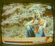
On June 9, 2006, TV Aragón presented a film report on the exhibition about the Azuara impact event. Settings of the film were
a geological exposure in the field and the impact exhibition in the town hall of Azuara both together with Ferran Claudin and Kord Ernstson.
a study in the university of Zaragoza with a computer monitor and a geological map presented by A. L. Cortés.
The reporter clearly presented both positions of the controversy underlined especially by the following subtitles in the TV:
Ferran Claudin and Kord Ernstson are working on the impact since two decades.
The impactor could have been a comet that hit the ground at a velocity between 20 and 70 km/s.
The exhibition in the Azuara town hall can also be visited in the Internet
And
The university of Zaragoza denies the existence of the impact of a meteorite.
Comment by F. Claudin & K. Ernstson
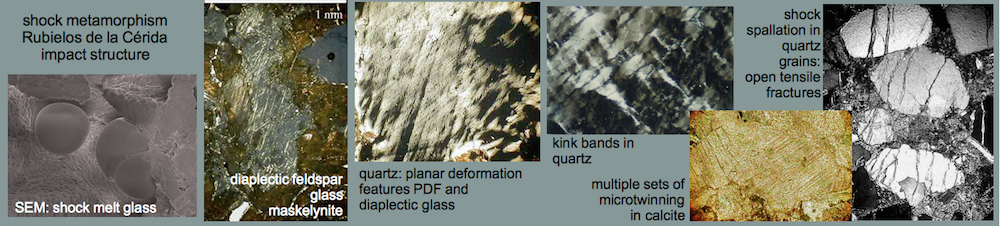
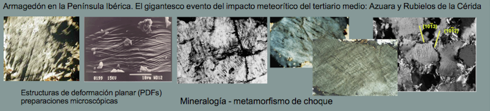
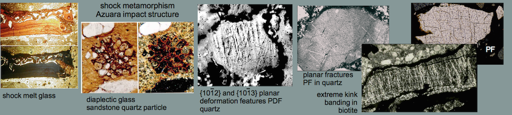
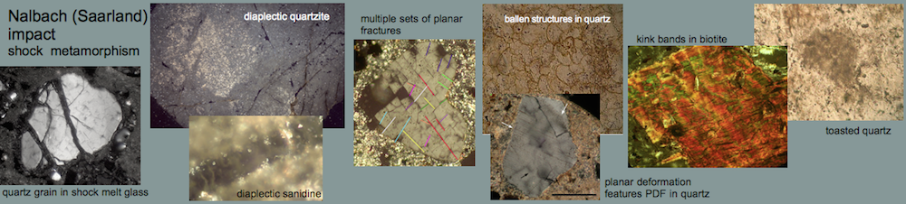
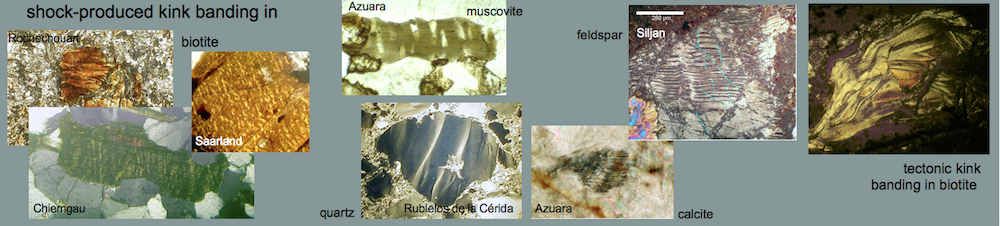
Although it would have been possible to film a joint discussion in the field or/and in the Azuara exhibition, A. L. Cortés preferred to avoid that (like with the inauguration of the Azuara impact exhibition, when the Zaragoza geologists had explicitly been invited but nobody came). Thus the Zaragoza geologists are practicing what they have been doing since 20 years: to refuse any joint field campaigns with the visit and discussion of impact outcrops as well as to refuse joint studies of Azuara shock effects (PDFs, shock melt, diaplectic glass etc) under the microscope.
Instead they are judging about the impact event from their studies extracting geological maps from their bookcases and regarding computer monitors. In the course of the 2001 IMPACT workshop in Granada they originally had the brilliant idea to discuss on the Azuara impact by presenting own videos of exposures. When we refused and in the end a field trip came about, they solely aimed to completely confuse the foreign participants and to utilize their very poor knowledge of the regional geology (see http://www.impact-structures.com/spain/workshop.htm).
Thus, presenting A. L. Cortés in his study was a nice documentation by TV Aragón about Zaragoza geologists’ considering the impact phenomena.
We would like to add some further comments on A. L. Cortés’ TV contribution. Neither Cortés nor any other geologists from the Zaragoza university have ever worked on meteorite impacts, and only recently a paleontologist from this university remarked that he cannot understand his geological colleagues who are discussing on impacts without any knowledge of this matter.
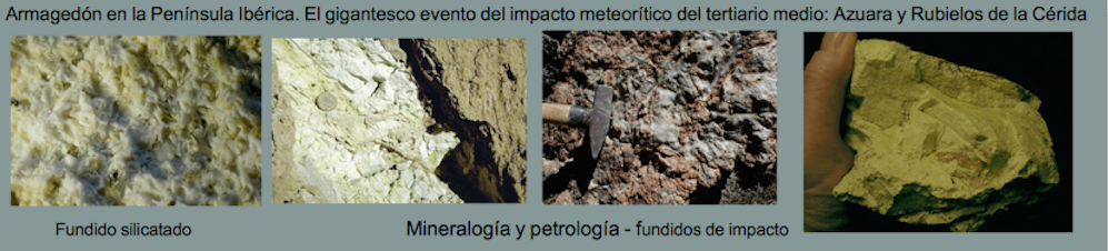
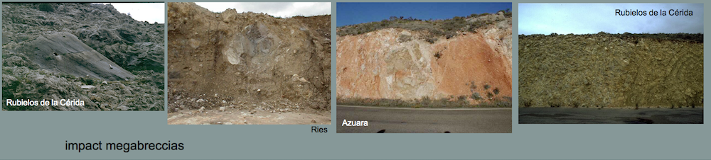
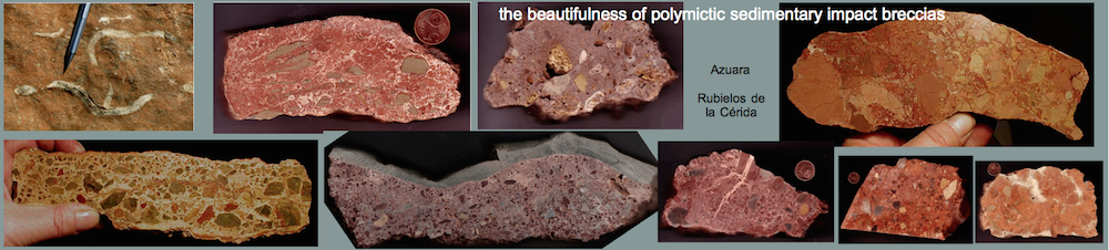
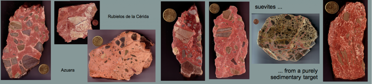
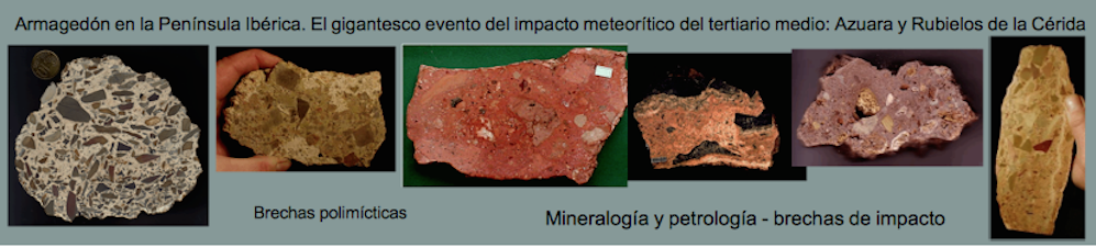
In the TV report, Cortés repeats the same old story that the Spanish regional geologists have made proper mapping and many thin-sections and that all impact evidences can be explained by normal geological processes. Cortés mentions once more the impact megabreccia as apparently exposed all over Spain and keeps completely quiet about his permanently confusing the facies of the Cortés de Tajuña Fm. with the impact megabreccia (see http://www.impact-structures.com/spain/controversy/megabrecha.htm ).
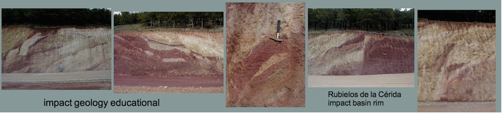
The geological mapping of Cortés and his colleagues is not as proper as he claims, and this is especially demonstrated by the large-scale erroneous mappings near Teruel or near Visiedo in the Rubielos de la Cérida impact basin. Near Visiedo, very large areas of outcropping Permotriassic sandstones and quartzites have been confused with Malmian limestones (!) both on the geological maps of 1 : 50 000 and 1 : 200 000 scales. The erroneous mapping near Teruel is especially highlighting, because Teruel has explicitly been mentioned by Cortés in the TV film. Near Teruel, the geological map shows an extremely curious setting. A large Buntsandstein complex of the size of many square kilometers is completely surrounded by and mapped in direct contact to the Rhaetian-Liassic (Cortés de Tajuña Fm.). The complete sequence of Muschelkalk and Keuper layers, several 100 meters thick, is absolutely missing on the geological map although otherwise always existent all over northern Spain. What’s the matter?
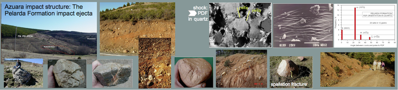
Going to the field, the Rhaetian-Liassic, mapped in direct contact to the Buntsandstein Fm. (Permotriassic), actually proves to be Muschelkalk limestones and dolomites and thus exhibiting the quite normal stratigraphic setting of Muschelkalk overlying Buntsandstein.
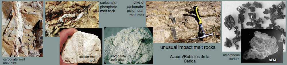
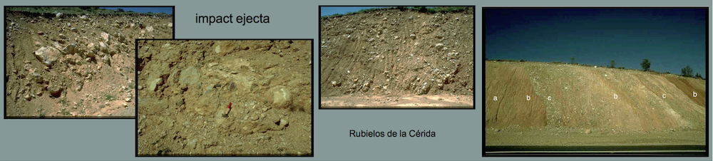
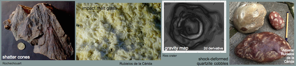
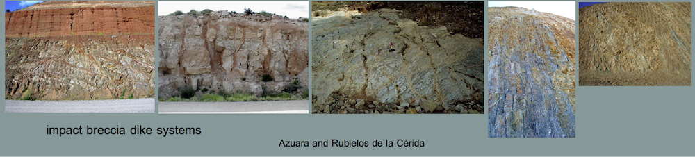
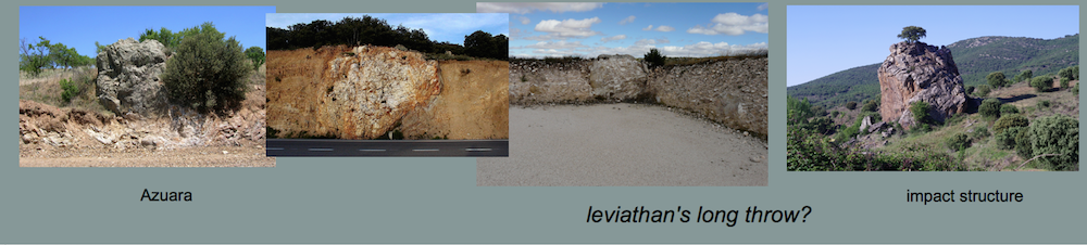
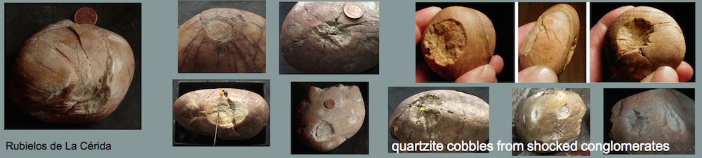
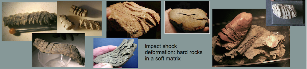
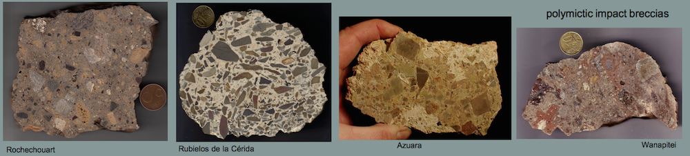
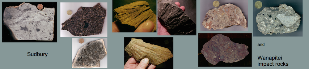
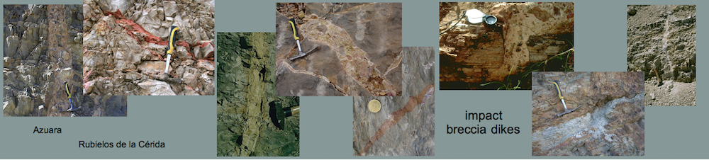
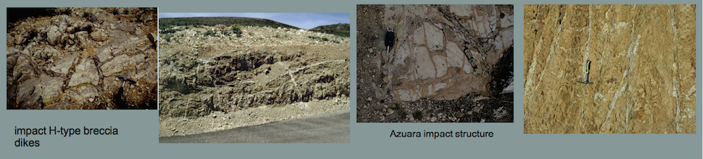
Why could the Muschelkalk have been completely confused with the Rhaetian-Liassic ? The reason is simple: The Buntsandstein complex and the surrounding Muschelkalk rocks are exposed exactly in the rim zone of the large Rubielos de la Cérida impact basin, where the Muschelkalk in the excavation and modification stage of impact cratering has been transformed to a giant megabreccia exposed over kilometers and kilometers (see http://www.impact-structures.com/Archiv/archiv.html) . And because evidently, for Cortés and his mapping colleagues the equation
extensive breccias = Cortés de Tajuña -Formation = Rhaeto-liassic age
automatically holds, the unbelievable confusion found its way to the geological maps.
So much about A. L. Cortés and his TV contribution about geological mapping and the «non-existing» impact.