by Kord Ernstson1, Uli Schüssler2, Ferran Claudin3 and Michael Hiltl4
Abstract. – We show and discuss unusual impact melt rocks from the sedimentary target of the Azuara/Rubielos de la Cérida multiple impact in Spain: a silicate melt rock originating from the melting of shale, a carbonate-phosphate melt rock showing liquid immiscibility of carbonate and phosphate melt, carbonate and sulfate melt rocks, a carbonate-psilomelane melt rock, and amorphous carbon particles in a microbreccia probably being carbon glass that has originated from the shock melting of Cretaceous coal.
______________________________________________________________________________________________________________________________________________
1.Fakultät für Geowissenschaften der Universität Würzburg, Pleicherwall 1, D-97070 Würzburg, Germany. kord@ernstson.de
2. Institut für Mineralogie der Universität Würzburg, Am Hubland, D-97074 Würzburg, Germany. uli.schuessler@mail.uni-wuerzburg.de
3. IES Giola, Llinars del Vallès. Barcelona-08450, Spain. fclaudin@pie.xtec.es
4. Carl Zeiss NTS GmbH, Carl-Zeiss-Str. 56, D-73447 Oberkochen, Germany. MHiltl@gmx.de
Introduction
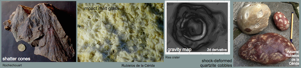
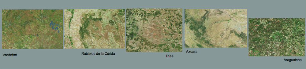
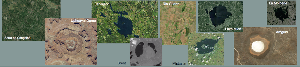
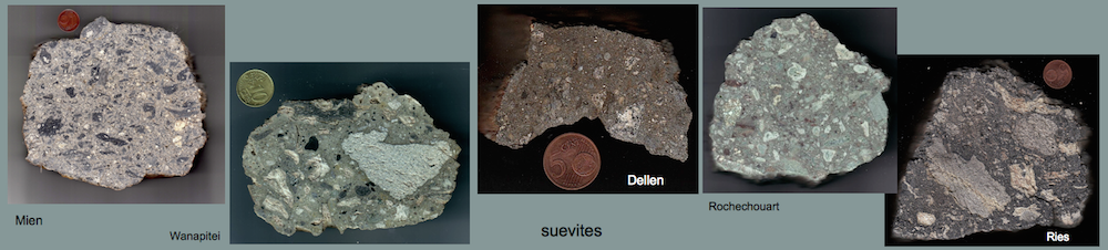
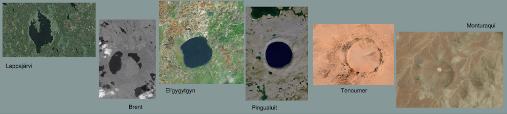
By definition [1], an impact melt rock is a crystalline rock that, in a meteorite impact event, has solidified from shock-produced impact melt and that contains variable amounts of rock fragments. On the other hand, shocked impact rocks that contain impact melt particles in a clastic matrix (clastic matrix = matrix of fragmental rock) are termed suevites or suevite breccias. Both impact melt rocks and suevites are well known from many impact structures which were formed in targets of crystalline basement rocks or in mixed targets of sedimentary rocks overlying crystalline basement rocks. In these craters, melt rocks and suevites may form more or less thick layers (melt sheets, suevite layers) that can normally be easily recognized (e.g., in the Mistastin, Vredefort, Lappajärvi, Sääksjärvi, Ries, Mien, Rochechouart impact structures, and in many others) and that are the source for collectors and collections of impactites. Impact structures in purely sedimentary targets, to the contrary, in general lack these impact melt rock and suevite layers, which has especially been pointed out by Kieffer & Simmonds [2]. They suggest that in sedimentary targets the high amount of volatiles (water vapor from shocked porous rocks, carbon dioxide from shocked carbonate rocks) prevents the formation of coherent melt masses. Instead, the shock-produced impact melt is finely dispersed by the volatiles to form microscopic glass particles only. In our opinion, there may be an additional reason for the apparent lack of melt rocks and suevites in impact structures in sedimentary targets. The rocks do exist, but they are not recognized as such. This may especially happen when the sedimentary target is composed to a large extent of carbonate rocks (limestones, dolomites) or/and evaporites (gypsum, anhydrite, chlorides). Carbonate rocks, e.g., are known to melt like other rocks, but the produced carbonate melt cannot be chilled to form glass, because it very rapidly crystallizes to form again a carbonate rock. Since the textures may show rough similarities, these crystallized carbonate melts may on cursory inspection be easily confused with normal limestones or soil formations as, e.g., calcrete (caliche). Gypsum, exposed to high shock-related temperatures, is transferred to anhydrite by loss of crystal water. Anhydrite may melt under complex conditions [3], but probably the melt upon cooling and in contact with water will crystallize again to gypsum. Likewise, during impacts in sedimentary, i.e. volatile-rich targets with variable lithology, high shock pressures and temperatures may lead to further complex melting and cooling processes and, in the end, to melt rocks of very peculiar composition and texture.
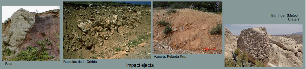
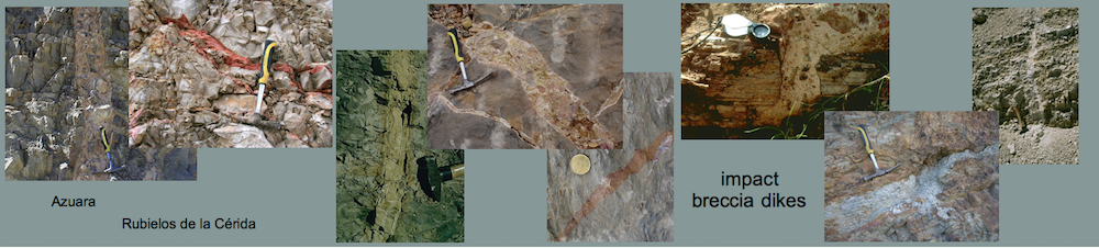
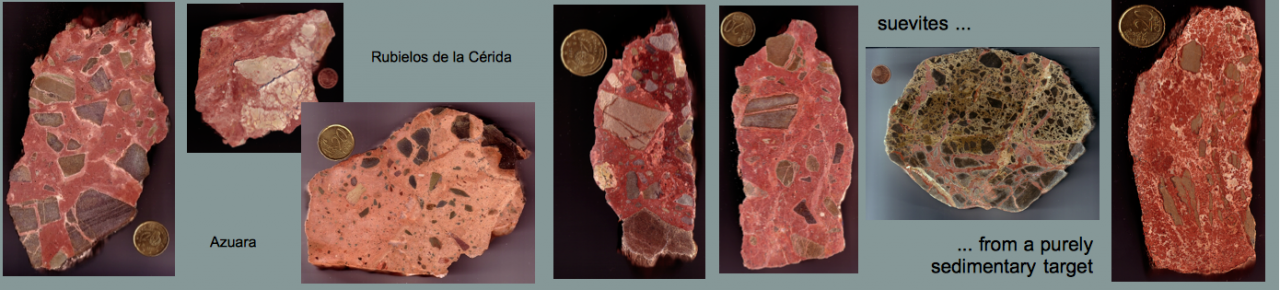
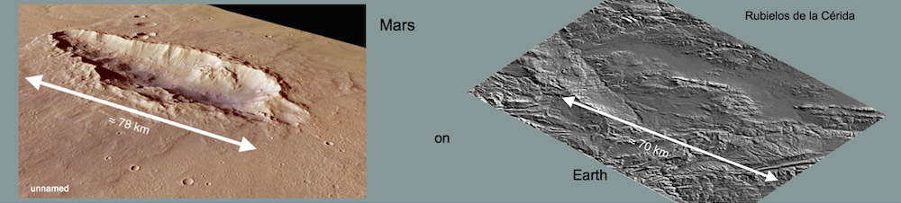
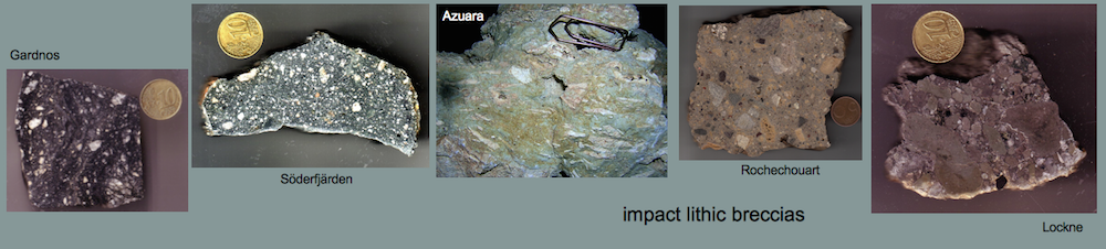
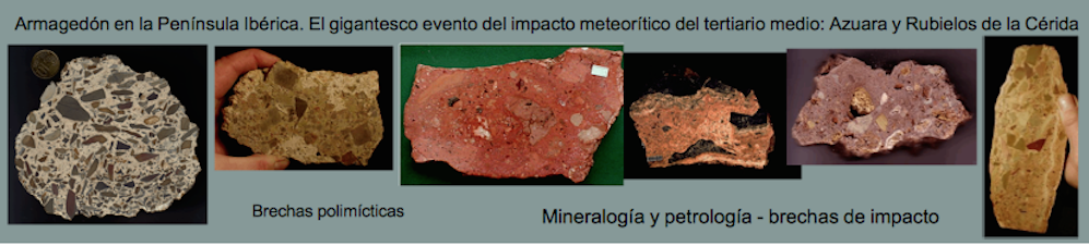
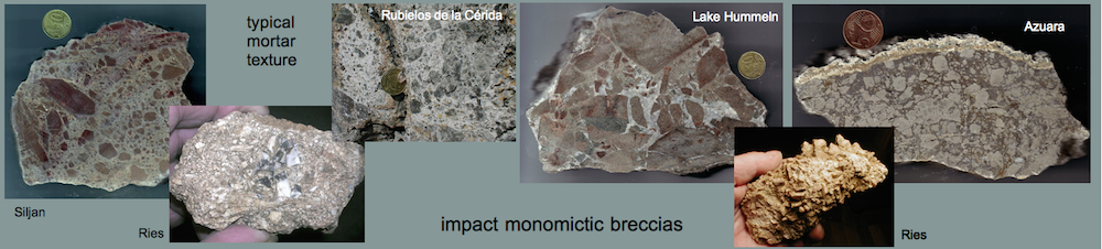
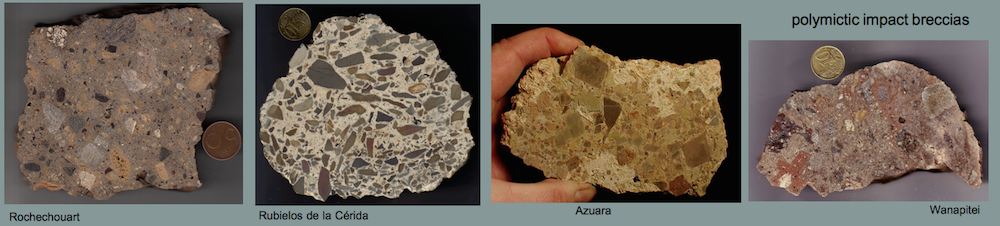
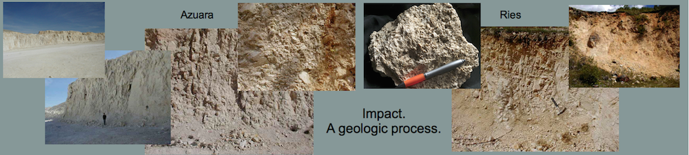
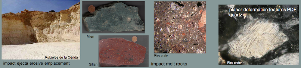
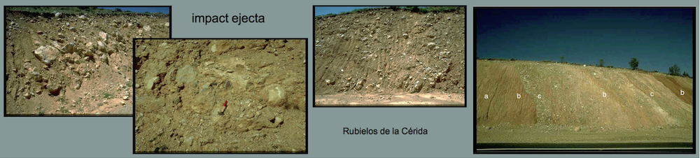
Here, we report on some unusual melt-bearing rocks and impact melt rocks that were produced in the Mid-Tertiary multiple impact on the Iberian Peninsula [, 4, 5, 6, 7]. The multiple impact comprises the 35-40 km-diameter Azuara structure, the Rubielos de la Cérida 40 km x 80 km impact crater chain, and suspected additional craters of smaller size. Exceptional with regard to the large crater diameters, the cosmic projectiles impacted a purely sedimentary target of roughly 10 km thickness. The unusual melt rocks to be described are related with the sedimentary target and partly with the contribution of carbonate and evaporite rocks. The suevite breccias abundantly exposed in the Azuara/Rubielos de la Cérida impact region [4, 6] will not be considered here.
Silicate melt rock
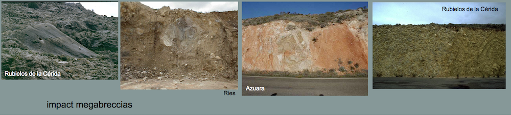
Many of the unusual melt rocks are intermixed in a polymictic megabreccia exposed along the road between the junction to Cutanda and the village of Barrachina in the Rubielos de la Cérida impact basin [6]. The polymictic megabreccia is assumed to have been formed in the impact cratering process by the deformation and intermixing of large rock complexes of different lithology (Fig. 1)

 Fig. 1. Two aspects of the megabreccia in the Rubielos de la Cérida impact basin. To the left: several blocks of different lithology in contact. A microbreccia exhibiting apophyses has been injected into the middle block. To the right: A body of silicate melt rock (the light ribbon) embedded in the megabreccia.
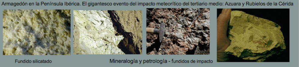
The silicate melt rocks occur as porous, fine-grained, whitish to yellowish blocks of variable size in a range of decimeters up to 1 – 2 meters (Fig. 1B), and they consist mainly of a milky white glass which forms tiny spheroids and lens-shaped bodies (Figs. 2, 3).
 Fig. 2. The glass of the silicate impact melt rock under the microscope. The field is 15 mm wide.

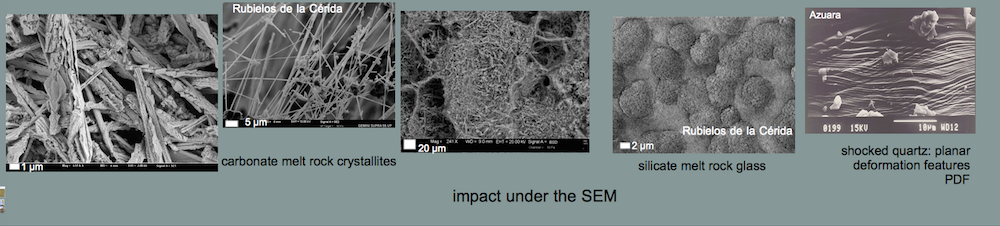
 Fig. 3. SEM images of the impact glass.
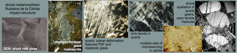
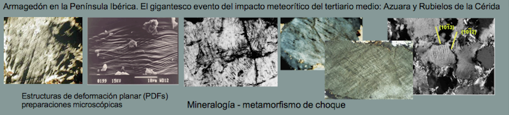
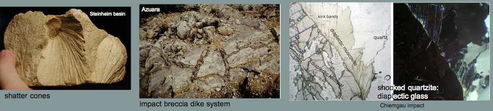
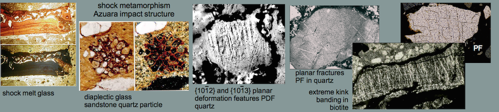
The glass is estimated to make up more than 90% of the rock. This is typically shown by a distinct amorphous glass “hump“ occurring in x-ray powder diffractograms. Some relics of plagioclase, quartz and mica within the glass masses are indicated by respective reflection peaks. Grains of quartz, twinned plagioclase and occasional mica are also found in thin sections of the glass matrix. In rare cases, the quartz fragments show planar deformation features (PDFs) and, more frequently, multiple sets of planar fractures (PFs), both indicative of impact shock. Feldspar grains show isotropization in the form of multiple sets of isotropic twinning lamellae and isotropic spots (diaplectic crystals), and they have sometimes become almost completely isotropic (diaplectic glass), indicating shock peak pressures of the order of 30 GPa (300 kbar). From a microprobe geochemical analysis we conclude that the glass has originated from the melting of shales very common in the sedimentary target. An interpretation of the glass to be volcanic ash as claimed by local geologists and, e.g., M. R. Rampino (written communication), can basically be excluded.
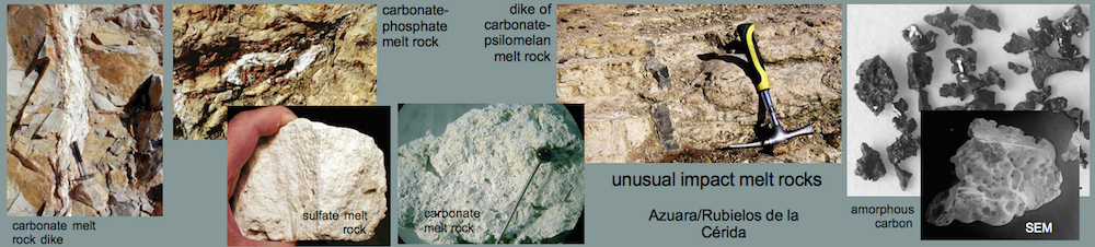
Carbonate-phosphate melt rock
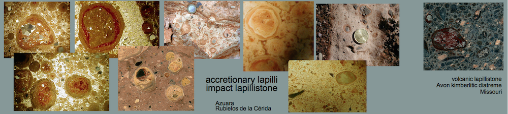
A very special kind of former melt was found also within the Barrachina megabreccia of the Rubielos de la Cérida impact basin [5]. The whitish melt rock (Fig. 4) is composed of irregular spheroids up to 4 mm in size, which are embedded within an
 Fig. 4. The white carbonate-phosphate melt rock embedded in a breccia composed of marl and limestone.
 Fig. 5. The carbonate-phosphate melt rock in close-up. Calcitic amoebic bodies are floating in phosphate glass (white). The field is 30 mm wide.
extremely fine-grained glass matrix (Fig. 5). In thin section (Fig. 6) and SEM image (Fig. 7), the spheroids turn out to be globular to amoeba-like calcite particles. They are coarse-grained in their centers and display decreasing grain size towards the rims. Regularly, a perpendicular grain orientation towards the rims is observed. The contact with the matrix is extremely fine-grained.
 Fig. 6. Photomicrograph of the carbonate-phosphate melt rock. The amoebae-like bodies composed of calcite crystals are surrounded by Ca-P glass that under crossed polarizers proves to be optically isotropic. Note the increasing size of the crystals towards the center of the calcitic bodies. Width of the field is 6 mm.
 Fig. 7. SEM image of the contact between amoebic calcite and phosphate glass in the carbonate-phosphate melt rock.
The glass matrix mainly consists of CaO and P2O5 with minor contents of F, S, Cl and NaO. Locally, a strong enrichment of Ba and S at the expense of the CaO and P2O5 content is observed. In part, the Ca-P glass is recrystallized to form apatite, as verified also by x-ray powder diffraction analysis. A similar melt rock has been reported for the suevite of the Ries crater. In the suevite, the calcite particles have identical structure and composition compared with the melt rocks of Barrachina and are interpreted as quench products of a carbonate melt [8]. Different from the Barrachina melt rocks, the matrix in the Ries samples is silicate glass as a result of carbonate-silicate liquid immiscibility. In our case, the melt rock displays a small-scaled immiscibility of coexisting former carbonate melt and phosphate melt.
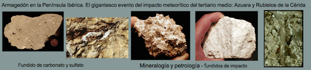
Sulfate melt rock
In the Barrachina megabreccia in the Rubielos de la Cérida impact basin, white clasts are embedded (Fig. 8) that consist of highly porous material (dry-rock densities of only 1.4 g/cm³ were measured). Only a few rock fragments are interspersed (Fig. 9). Chemically, the white material is nearly pure CaSO4. In thin section, the matrix may show flow texture but is otherwise not resolved by the optical microscope. SEM images (Fig. 10) show a distinct vesicular texture obviously related with the high porosity. Mineral fragments, mostly quartz and feldspar, are partly strongly shocked (PDFs, diaplectic glass). Shock effects occur also in minerals of the interspersed rock fragments.
 Fig. 8. Block of probable sulfate melt rock embedded in the megabreccia.
 Fig. 9. Clast of highly porous calcium sulfate probably crystallized from a sulfate melt. Note the enclosed quartzite fragments.

 Fig. 10. SEM images of the sawed surface of probable sulfate melt rock. Note the vesicular texture.
Obviously, the CaSO4 material is not a chemical sediment (gypsum, anhydrite), and a pedogenic origin can clearly be excluded. With respect to the high porosity, the flow texture and the strong shock effects, we suggest the clasts to have formed by crystallization from a shock-produced sulfate melt. The melting point of anhydrite is 1,750 K, a temperature which must have been exceeded to produce the silicate melt in the Barrachina megabreccia (see above, and [6]). Crystallization from an anhydrite melt is also discussed for material in suevite breccias from the Chicxulub impact structure [9] and in impactites from the Haughton impact structure [10].
Carbonate melt rocks
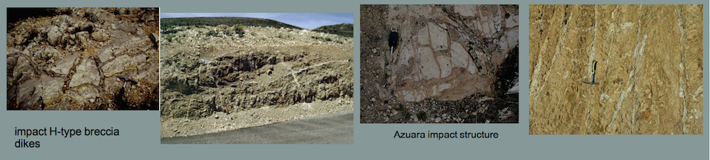
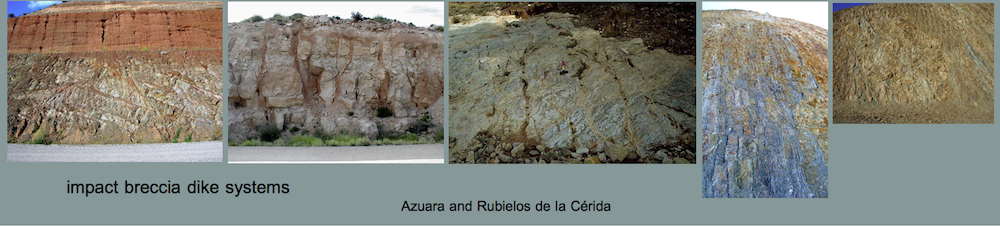
Abundant relics of former carbonate melt are proposed to occur in the Azuara impact structure and the Rubielos de la Cérida companion impact basin [6]. They are found in the form of decimeter and meter-sized blocks, as dikes cutting sharply through the country rock (Fig. 10), and as highly porous, foamy and feathery material within brecciated rocks. As already mentioned, carbonate melt cannot be chilled to form glass, but rapidly crystallizes to carbonate again Therefore, the origin from a melt can only indirectly be suggested by the occurrence of skeletal, dendritic crystallites, vesicular texture and related features. Typical carbonate rocks which we interpret to have crystallized from a carbonate melt are shown in Figs. 11, 12 and 13.
 Fig. 11. A dike of highly porous carbonate melt rock cutting through Jurassic limestones.
 Fig. 12. Highly vesicular skeletal carbonate rock probably originating from the decomposition and melting of a limestone or dolomite.

Fig. 13. SEM images of the relics of carbonate melt. Note the vesicular felted texture (to the left) and the dendritic crystallites (to the right). SEM analyses establish calcium carbonate and traces of quartz.
Carbonate-psilomelane melt rock
The southwestern rim area of the Azuara impact structure is characterized by a variety of quite different impact breccia dikes. Close to the village of Monforte de Moyuela, an outcrop was found where autochthonous Muschelkalk dolomite is crosscut by a dike of dark material (Figs. 14, 15; UTM coordinates of the outcrop are 06 67 200/ 45 46 300; also see [11]).
 Fig. 14. A dike of carbonate-psilomelane melt rock cutting through Muschelkalk dolomite.
 Fig. 15. Section across the dike of carbonate-psilomelane melt rock (m) . d = dolomite host rock, c = seam of calcite grown perpendicular to the wall of the dike.
 Fig. 16. Photomicrograph of the carbonate-phosphate melt rock. Note the many gas vesicles (gv). The field is 1 mm wide.
As shown by thin sections under the microscope, the dike consists of a light matrix of carbonate minerals, hosting a high amount of black spherical to amoebic particles (Fig. 16) which show gel-like layered structure in the reflective light. The rim (c in Fig. 15) towards the dolomite country rock (d in Fig. 15) is characterized by pure carbonate crystals having grown perpendicular to the wall of the dike. A typical feature of the dike is the high amount of gas vesicles (Fig. 16). The gel-structured black particles turned out to be ore minerals containing Mn and Ba as major elements beside highly variable amounts of light components like H2O. After HCl treatment and removal of the carbonate matrix of a black vein sample, the remnant in an x-ray powder diffractogram was identified as a very imperfectly crystallized psilomelane (a hydrated manganese oxide). At first glance the calcite-psilomelane composition of the dike may be explained by hydrothermal or weathering fluids having circulated through the rocks. Two features, however, do not really match this point of view:
— The very high amount of gas vesicles is totally uncommon for hydrothermal dikes and can only be explained by rapid melting-cooling processes with incomplete degassing of the melt.
— The growth of the calcite crystals (c in Fig. 15) perpendicular to the wall of the dike again clearly points to crystal growth from a melt, perpendicular to the cooling front. Similar calcite growth has been observed in amoebic carbonate particles embedded in phosphate or silicate glass matrix of suevite samples from the Rubielos de la Cérida and the Nördlinger Ries impact structures, respectively (see above, Carbonate-phosphate melt rock). This texture has been interpreted as the result of a quench crystallization from a carbonate melt. As a conclusion, the psilomelane-calcite dike turns out to be a former manganese-bearing carbonate melt which was injected into cracks at the crater floor and then rapidly cooled. Probably the psilomelane is secondary and formed by replacing a primary Mn mineral. Mn, partly in minable quantities, is not uncommon in the target rocks of the impact structure.
Melt rock from Almonacid de la Cuba
The peculiar rock shown in Fig. 17 is exposed near the village of Almonacid de la Cuba at the NE ring of the Azuara impact structure (UTM coordinates 6 84 300, 45 73 900) and is so far unique with respect to occurrence, composition and texture. A comparable rock is completely unknown in the stratigraphic record of northern Spain. Within a dense to porous and even foamy greyish carbonate matrix, components of snow-white color are embedded, which may be extremely vesicular as
 Fig. 17. Sawed surface of the Almonacid de la Cuba impactite.
shown in the photograph (Fig. 17). The rock forms an extensive deposit, which has in detail been investigated by Tanja Katschorek [12]. From field work and petrographic analyses, she concludes that the deposit has resulted from an expanded, turbulent, and dilute flow by inclusion of considerable amounts of carbonate melt, similar to volcanic surges. The matrix may have solidified completely from a carbonate melt giving the rock the character of an impact melt rock [1].
Amorphous carbon in a microbreccia – solidified from a carbon melt?
In the Barrachina megabreccia referred to above, blocks of a fine-grained microbreccia (Fig. 1) are locally intercalated. The microbreccia consists of loosely cemented carbonate and, subordinate, quartz particles. Small black clasts measuring between 0.5 and 2 mm are widespread and striking. Two kinds of these black components can be distinguished. The first kind is ordinary charcoal which under the microscope shows the typical charcoal structure. The second kind of black particles is very hard, occurs in very irregular forms and has a surface gleaming like glass (Fig. 18). Qualitative microprobe element scans show the particles to be composed of carbon and oxygen as the only major components. Additional elements are Ca and S in varying concentrations. X-ray powder diffraction analysis of the particles resulted in diffractograms without any reflections, but showing a typical amorphous glass “hump“.
 Fig. 18. Particles of amorphous carbon in an unknown compound with oxygen. Scale bar 1 mm.
 Fig. 19. SEM image of an amorphous carbon particle from the Rubielos de la Cérida microbreccia.
 Fig. 20. SEM image of a fracture surface of an amorphous carbon particle. Note the lancet markings typical of glass fracture.
Carbon in elemental form has repeatedly been described from impact structures [e.g., 13, 14]. As has been shown by hypervelocity impact experiments [13], a possible source of elemental carbon is carbonate rocks, which could also apply to the carbonate-rich target of the Rubielos de la Cérida structure. As a further possibility and taking into account the glass-like appearance (Figs. 18, 19, 20) and the irregular shapes of the particles, the amorphous carbon may be quenched carbon melt from extremely shocked coal of the Cretaceous Utrillas lignite deposits in the target. Carbon melts at temperatures of roughly 3,800 K which, in a hypervelocity meteorite impact, is exceeded at highest shock levels. From stratigraphical considerations, the lignite layers could have been deposited in the very center of the Rubielos de la Cérida structure. The role of remarkable contents of oxygen detected in the carbon particles is still unclear. Compounds of carbon and oxygen do not occur in solid state. We propose the possibility that the carbon may occur as fullerenes which are able to trap gases within their cages. Fullerenes have been reported in relation with the Sudbury impact structure and the Permian-Triassic boundary [15, 16].
Conclusions
We have presented and discussed seven different rocks from the area of the Azuara/Rubielos de la Cérida impact. They have either been solidified from a melt, or they contain glass that has been quenched from a melt. However, not all aspects of their formation are completely understood which is related with the generally poor knowledge of the formation of carbonate and sulfate melts in the impact cratering process. The rocks prove to be rather inconspicuous and unprepossessing, and for rock hunters they may be the Ugly Ducklings among the impactites. That is why they probably have never been recognized by geologists previous to the discovery of the large impact event. Without closer inspection, the mostly whitish, yellowish and greyish rocks have either not been given further consideration, or they have been confused with common carbonate rocks or soil formations like calcrete (caliche), and dike-like occurrences of melt rocks and melt-bearing rocks were regarded as karst features, e.g., by local geologists. From our experiences in the Azuara and Rubielos de la Cérida impact area with rocks originating from the melting of sediments we suggest that in impact structures in sedimentary i.e. volatile-rich targets, there may generally be more impact melt rocks than previously assumed. In impact research, this idea gains acceptance only hesitantly (see e.g., [17].
References
[1] IUGS Subcommission on the Systematics of Metamorphic Rocks, Study Group for Impactites.
[2] Kieffer, S. W. and Simonds, C. S. (1980). The role of volatiles and lithology in the impact cratering process. Review of Geophys. and Space Physics, 18: 143-181.
[3] Ivanov, B.A., Langenhorst, F., Deutsch, A. and Hornemann U. (2003). Theoretical constraints on shock melting and decomposition of anhydrite. Bayerisches Geoinstitut, Bayreuth, Annunal Report 2003.
[4] Ernstson, K. and Fiebag, J. 1992. The Azuara impact structure: New insights from geophysical and geological investigations. Geol. Rundschau, 81: 403-427.
[5] Ernstson, K., Schüssler, U., Claudin, F. & Ernstson, T. (2003). An impact crater chain in northern Spain. Meteorite, 9, no 3, 35-39.
[6] Ernstson, K., Claudin, F., Schüssler, U. & Hradil, K. (2002). The mid-Tertiary Azuara and Rubielos de la Cérida paired impact structures (Spain).Treballs del Museu de Geologia de Barcelona. 11: 5-65.
[7] Ernstson, K., Claudin, F., Schüssler, U., Anguita, F. and Ernstson, T. (2001). Impact melt rocks, shock metamorphism, and structural features in the Rubielos de la Cérida structure, Spain: evidence for a companion to the Azuara impact structure, in: Impact markers in the stratigraphic record, 6th ESF-IMPACT workshop Granada, abstract book: 23-24.
[8] Graup, G. (1999). Carbonate-silicate liquid immiscibility upon impact melting: Ries Crater, Germany. Meteoritics Planet. Sci., 34: 425-438.
[9] Claeys, P., Heuschkel, S, Lounejeva-Baturina, E., Sanchez-Rubio, G., and Stöffler, D. (2003). The suevite of drill hole Yucatàn 6 in the Chicxulub impact crater. Meteor. Planet. Sci., 38, 1299-1317.
[10] Osinski, G.R. and Spray, J.G. (2003). Evidence for the shock melting of sulfates from the Haughton impact structure, Canada. Abstract, 6th Annual Meteoritical Society Meeting.
[11] Schüssler, U., Ernstson, T., and Ernstson, K. (2004). Impact-induced carbonate-psilomelane vein in the Azuara structure of northeastern Spain. www.uni-wuerzburg.de/mineralogie/schuessler/Monforte-vein.pdf.
[12] Katschorek, T. (1990). Geological investigations at the northern rim of the Azuara structure (NE Spain). Diploma thesis (in German), University of Würzburg.
[13] Bunch, T. E., Becker, L., Schultz, P. H. and Wolbach, W. S. (1997). New potential sources for Black Onaping carbon. Large Meteorite Impacts and Planetary Evolution, 30. 8. – 5. 9. 1997, Sudbury, abstracts.
[14] Heymann, D. and Dressler, B. O. 1997. Origin of carbonaceous matter in rocks from the Whitewater Group of the Sudbury structure. Large Meteorite Impacts and Planetary Evolution, 30. 8. – 5. 9. 1997, Sudbury, abstracts.
[15] Becker, L., Poreda, R. J., Bada, J. L. (1996). Extraterrestrial Helium Trapped in Fullerenes in the Sudbury Impact Structure. Science, 272: 249-252.
[16] Becker, L., Poreda, R. J., Hunt, A. G., Bunch, T. E. and Rampino, M. R. (2001). Impact event at the Permian-Triassic boundary: evidence from extraterrestrial noble gases in fullerenes. Science, 291: 1530 – 1533.
[17] G. R. Osinski and H. J. Melosh (2004). Impactites on Mars: What should we expect and what is the role of volatiles? Second Conference on Early Mars, Jackson Hole, abstract.